
Serving Barnwell County and it's neighbors since 1852
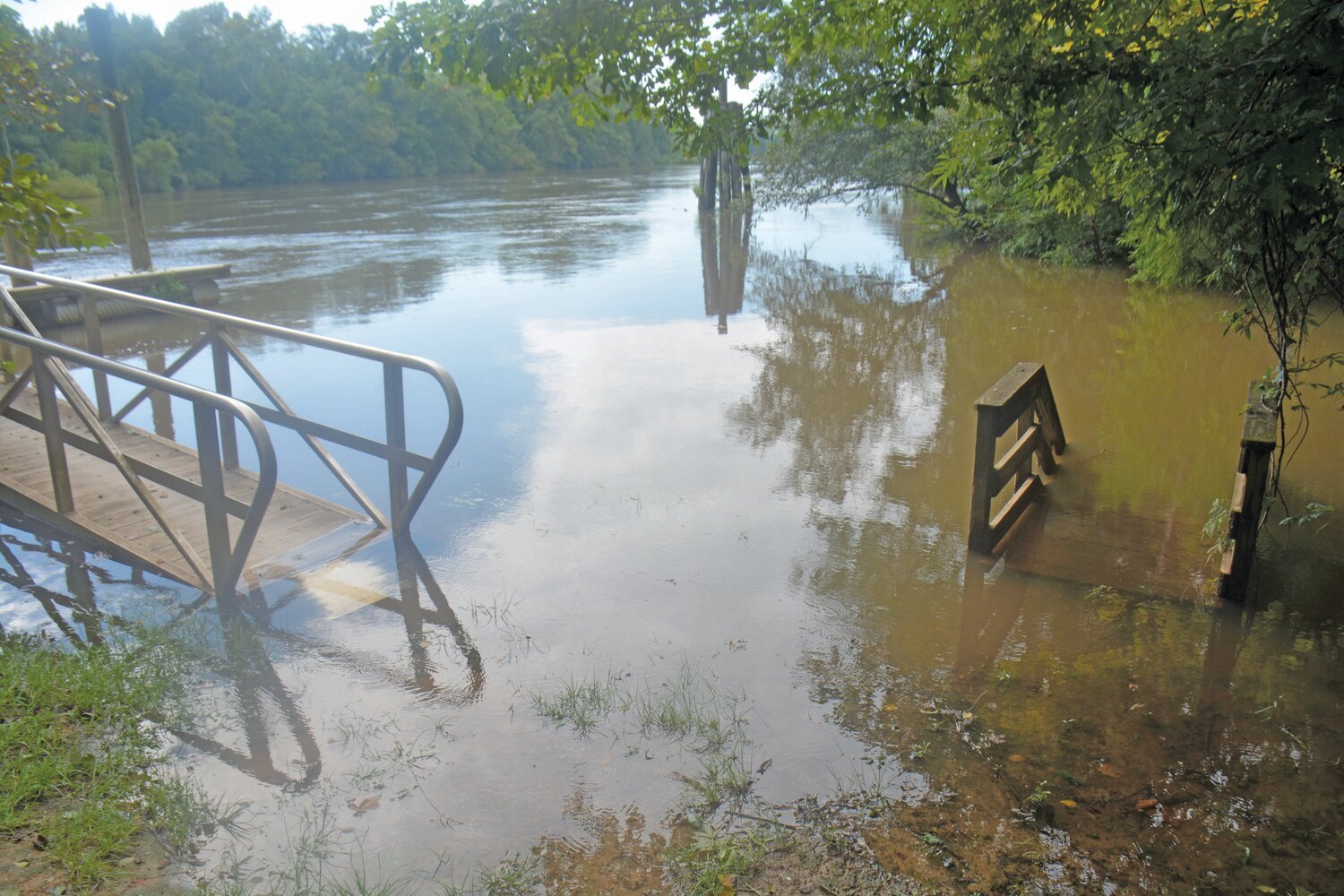
On August 31, after heavy rainfall brought by Hurricane Idalia, the Savannah River flooded past its banks and onto the launch ports for boats.
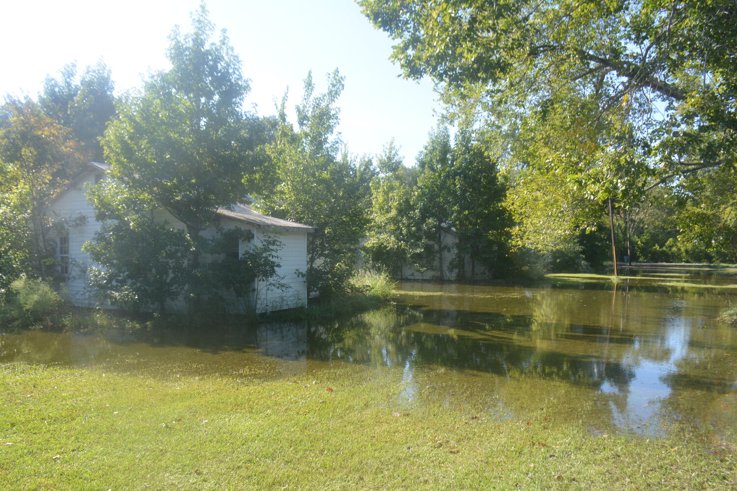
Houses in Fairfax on Thursday, August 31, after Hurricane Idalia brought intense levels of rainfall to Allendale County.

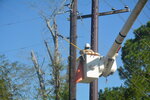
A lineman busy at work after falling trees brought down power lines throughout communities in Allendale and Bamberg counties.
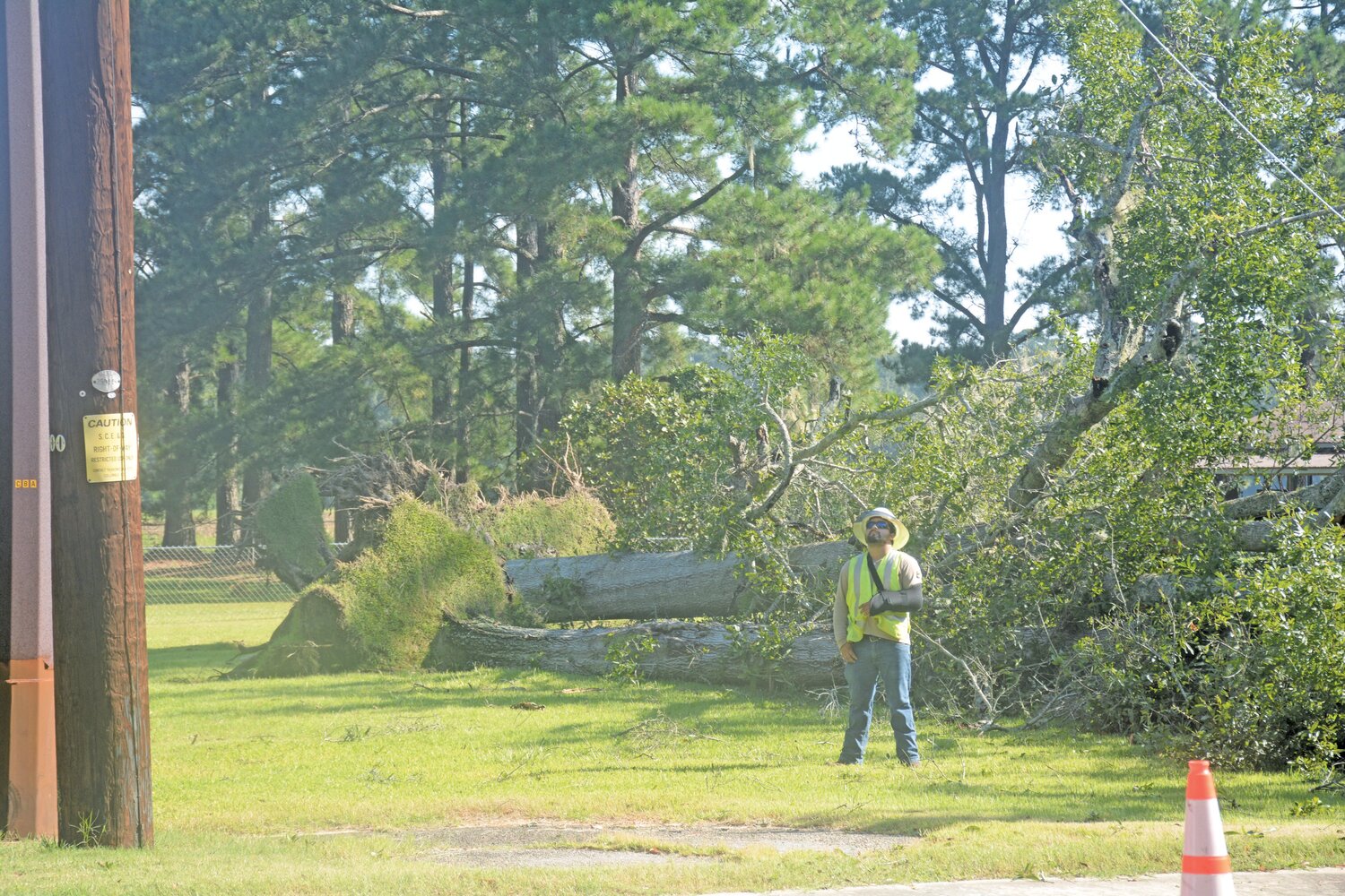
A lineman stands in front of fallen trees while watching a colleague repair a telephone pole after Hurricane Idalia struck Allendale.

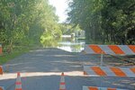
After Hurricane Idalia swept through South Carolina, low-lying streets in the area were flooded.

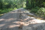
A dirt road in Fairfax, eroded away by flooding caused by Hurricane Idalia’s rainfall.
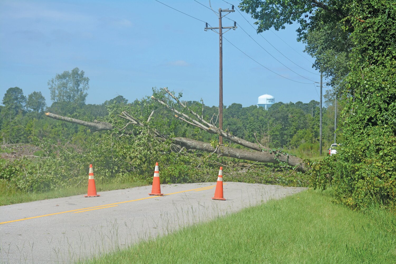
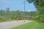
A fallen tree blocks a road in Bamberg after Hurricane Idalia's intensity brought down trees in the region.


Last Wednesday, as sheets of Hurricane Idalia’s rainfall swept through the tri-county area of Barnwell, Allendale and Bamberg counties, the branch of a falling tree smashed through the ceiling of Barnwell resident Yanette Bryant Dunbar’s apartment like a spear. At the time, Dunbar had a guest sleeping in the room, and the branch almost hit him in the chest.
“It was a big boom, it was very loud,” Dunbar said. “It all happened so quickly. I got woken up to ‘Hey, a tree came in and almost hit my chest.’ He was like ‘Oh my god.’”
Although Hurricane Idalia’s trajectory caused it to miss hitting the tri-county region directly, the storm did flood some streets, cut power to homes and brought down trees like the one that landed on Dunbar’s house. To get power back, the region’s linemen worked around the clock. The storm is the first of the 2023 hurricane season, which scientists predict will be above average in intensity as a result of record-breaking Atlantic Ocean temperatures due to climate change.
Local effects
School districts, businesses and government buildings closed down throughout the tri-county region in preparation for the worst of Idalia. However, the extent of damage was limited in comparison to other areas of the southeast like the Florida panhandle, southeast Georgia and Charleston, which were in the hurricane’s path.
On Thursday morning, linemen were busy on Allendale’s Route 301, where multiple large trees fell, bringing down power lines on the side of the highway heading towards Georgia. In Fairfax, flooding led to water pools forming under several homes as the ground struggled to hold water. The Savannah River swelled past its shorelines, carrying sticks and broken trees down towards the sea.
Edisto Electric Cooperative, which supplies electricity to people throughout Barnwell, Allendale and Bamberg, reported 2,000 outages in an August 31 Facebook post the day after the storm.
In Bamberg, power lines were also brought down by falling trees that could not withstand the hurricane’s strong winds and flooding. On Wednesday, The National Weather Service recorded 6.3 inches of rain in Bamberg County while Clemson University reported 5.8 inches of rain.
The flooding in the region was made less severe thanks to its wetlands, which help absorb water, keeping it from flooding into farmlands and roadways. The tri-county area’s ecosystems are key natural barriers that help protect the community against increasing storm intensity, according to wetlands research done at Clemson University.
Edisto Electric Cooperative, which supplies electricity to people throughout Barnwell, Allendale and Bamberg, reported 800 outages in a Facebook post.
While atmospheres are warming quickly, oceans have absorbed 90% of the excess heat caused by burning fossil fuels. NASA has found that since the 1970s, ocean temperatures have rapidly risen. Both rising ocean temperatures and sea levels due to glacial melt increase hurricane intensity.
The ecosystems and geology of Barnwell, Allendale and the surrounding counties are some of the natural barriers that help protect the community against this increasing storm intensity.
Additionally, the region also has a high number of wetlands, which are critical ecosystems that absorb water and make flooding less likely. However, over time, South Carolina has experienced enormous losses of wetlands as a result of industrial development and agriculture. Since the 1700s, South Carolina has lost 27% of its wetlands due to human activity.
2023’s elevated hurricane season
Currently, the world is experiencing the El Niño weather cycle, which occurs when the Pacific Ocean heats to 0.5 degrees Celsius above normal, according to the National Oceanic and Atmospheric Administration (NOAA). This results in increased wind shear that heads from the west coast of the United States to the east coast. Typically, the El Niño weather cycle’s west to east wind shear competes with winds in the Atlantic, which typically move from east to west, making hurricanes less likely during El Niño years.
“As storms start to form off the coast of Africa, winds coming across can break them up, and that tends to be higher during El Niño years,” said Christopher Hein, associate professor at the Virginia Institute of Marine Science. “It’s a little bit more difficult for them to form during those years simply because of atmospheric dynamics.”
However, this year is unique. Despite wind shear, this year is 130 percent above normal for hurricanes, and the east coast is twice as likely to be hit by a hurricane according to Matt Rosencrans, a researcher at the Climate Prediction Center of NOAA.
Rosencrans said that climate models at NOAA are still determining the extent that climate change influenced Hurricane Idalia. However, Jeff Masters, a hurricane scientist formerly at NOAA, has calculated that climate change increased Idalia’s power by 40-50 percent.
“Those warmer waters are just continual fuel for a storm to keep strengthening,” Rosencrans said. “When you have warmer sea surface temperatures, they’re more supportive of thunderstorms and clusters of storms forming over the ocean. The warmer those waters, the more likely that is to happen, because they have more energy to work with.”
The past few years of off-the-charts ocean temperatures, which scientists have attributed to climate change, make hurricanes increasingly more powerful. This summer, marine temperatures in the Atlantic Ocean rose to the hottest levels in recorded human history, with some water temperatures off the coast of Florida over 100 degrees.
“What we’re going to see and what we’re already witnessing is more variability,” Hein said. “There’s more energy in the [climate] system, so there’s more variability in the system. Because the atmosphere is warmer and because the oceans are warmer, there’s more energy to increase storm power. Energy drives variability.”


